Waterberg District (Limpopo river basin, South Africa)
Hydrology and Water Infrastructures
From a hydrological perspective, five basins fall within the Waterberg District's administrative boundaries: The Lower Crocodile River Sub-basin, the Mokolo River basin, which includes the Tambotie tributary, the Lephalala River basin, the Mogalakwena River basin, and a small area of the Olifants River basin. Most of these rivers flow towards the North-West and drain into the Limpopo River Basin (Department of Environmental Affairs, n.d.).
The Vaalkop, Roodekopjes, Klipvoor, and Bierspruit Dams feed water into the Lower Crocodile River area. As a result, the ecological status of the Lower Crocodile River is categorized as poor. Over the past years, the extensive irrigation and abstraction points along the river systems have compromised the river's natural flow regime and functioning (Department of Forestry, Fisheries and the Environment, n.d.).
The Mokolo river and its tributaries drain an area of 8,450 km². The river system receives water from the Waterberg mountain range. Human activities influenced and changed the river system substantially. One important example is the construction of the Mokolo Dam in the late 1970s. The Molokolo dam supplies water to the Matimba Power Station, the Grootegeluk Coal Mine, and the greater Ellisras area. In addition, the dam is crucial to the users downstream since water from the dam is also allocated to farmers for irrigation purposes (Department of Forestry, Fisheries and the Environment, n.d.).
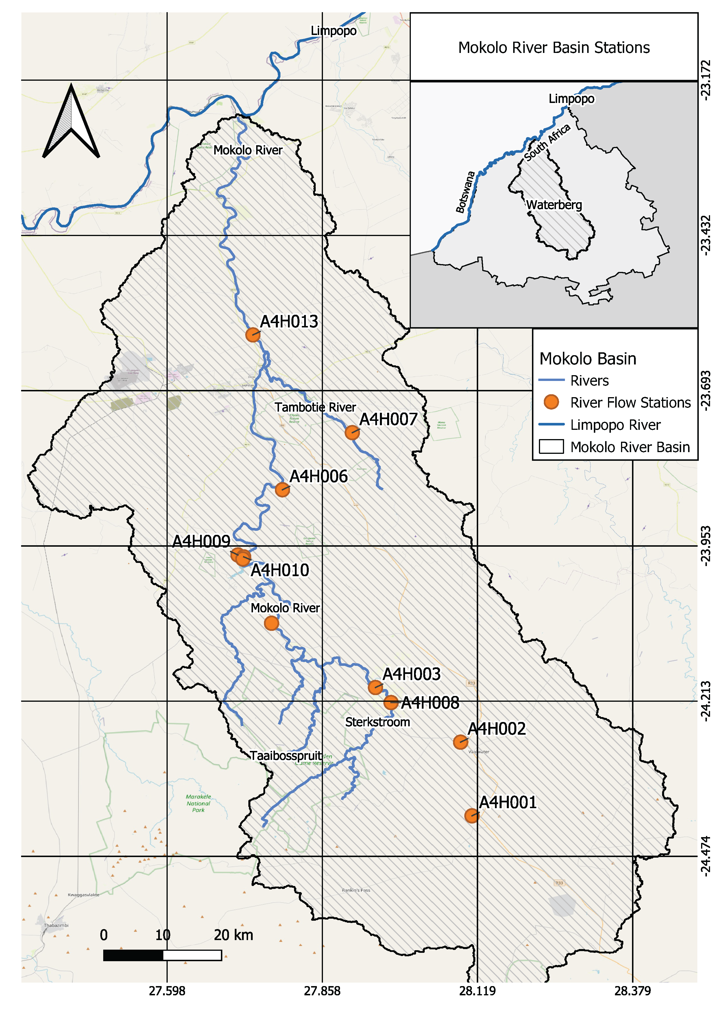
Figure 1: Overview of the Mokolo River basin (Map by Juan Miguel Viquez & Daniel Knopp).
The Lephalala River basin is also part of the Waterberg District. However, the basin has no significant dams, and water use for irrigation is limited (Department of Forestry, Fisheries and the Environment, n.d.).
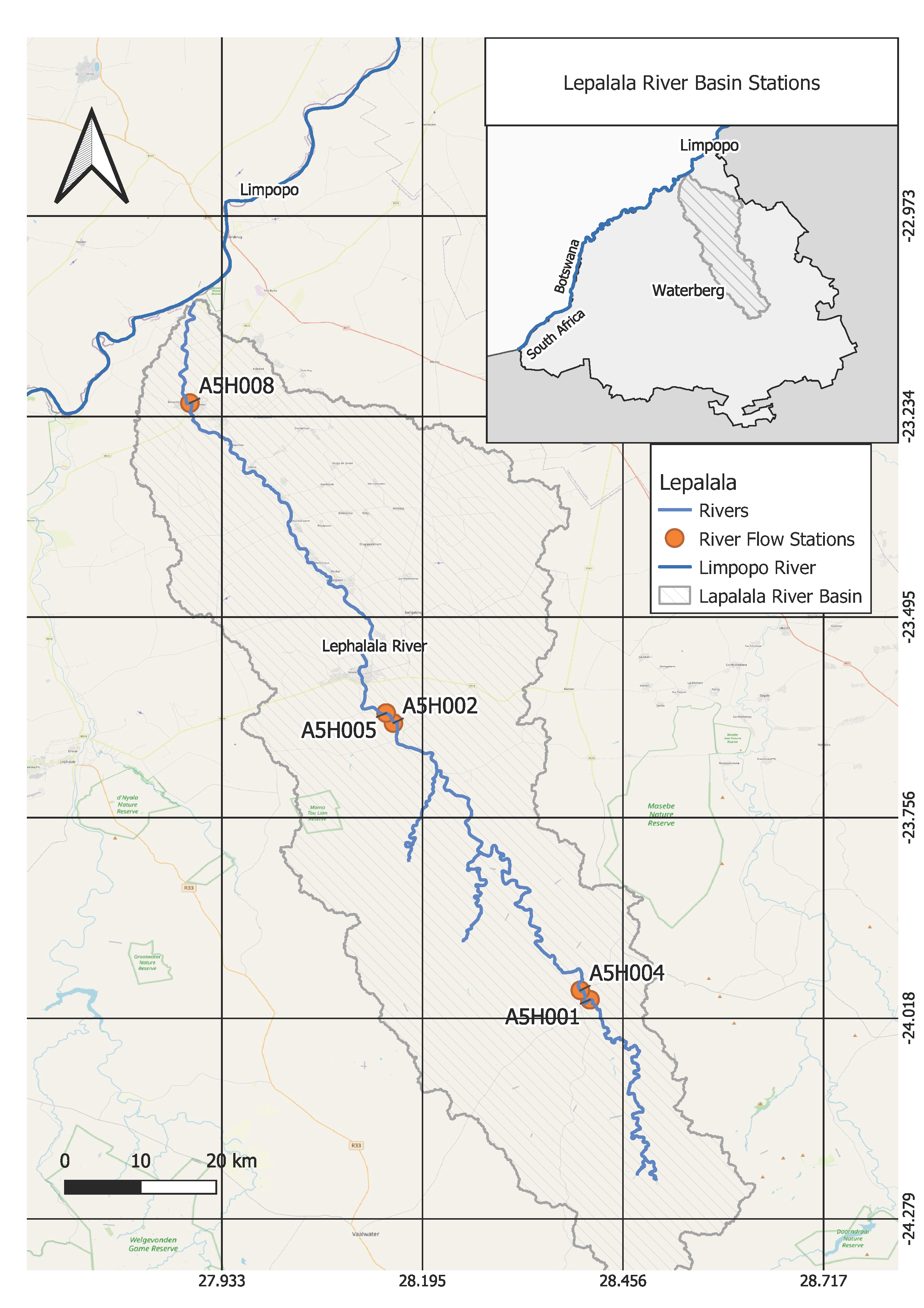
Figure 2: Overview of the Lephalala River basin (Map by Juan Miguel Viquez & Daniel Knopp).
The Mogalakwena River basin has two significant dams: the Glen Alphine Dam and the Doringdraai Dam. The Glen Alphine Dam provides water for irrigation in the adjacent downstream area (Department of Forestry, Fisheries and the Environment, n.d.). A detailed map of the Mogalakwena River is shown below.

Figure 3: Overview of the Mogalakwena River basin (Map by Juan Miguel Viquez & Daniel Knopp).
Despite the constructed water infrastructures, water remains a scarce resourse in the Waterberg District.
Groundwater
Groundwater plays a vital role in the Waterberg District. In general, groundwater is available in the area and usually provides the primary source of water supply in rural communities. Furthermore, groundwater is used for irrigation and mining purposes, mainly in the platinum mines west of Mokopane (Department of Forestry, Fisheries and the Environment, n.d.).
References
Department of Forestry, Fisheries and the Environment (n.d.): Environmental Management Framework for the Waterberg District. Status Quo Report. Available at: https://www.dffe.gov.za/sites/default/files/docs/waterberg_statusquo_finalreport.pdf
The Department of Environmental Affairs (n.d.): Waterberg District Environmental Management Framework Report. Available at: https://www.dffe.gov.za/sites/default/files/docs/waterberg_finalreport.pdf