Waterberg District (Limpopo River Basin, South Africa)
Climate
The Limpopo basin is mainly located within Koeppen climate zone BSh, representing a semiarid, dry, hot climate. The map below shows that some south and central basin areas lie within a C-type climate. The average annual rainfall is 450 mm but varies considerably across the basin. Between 1979-2013, rainfall reached 160mm/yr in the west of the basin and 1,152mm/yr in the east and southeast areas at the coast (Knight, 2022).
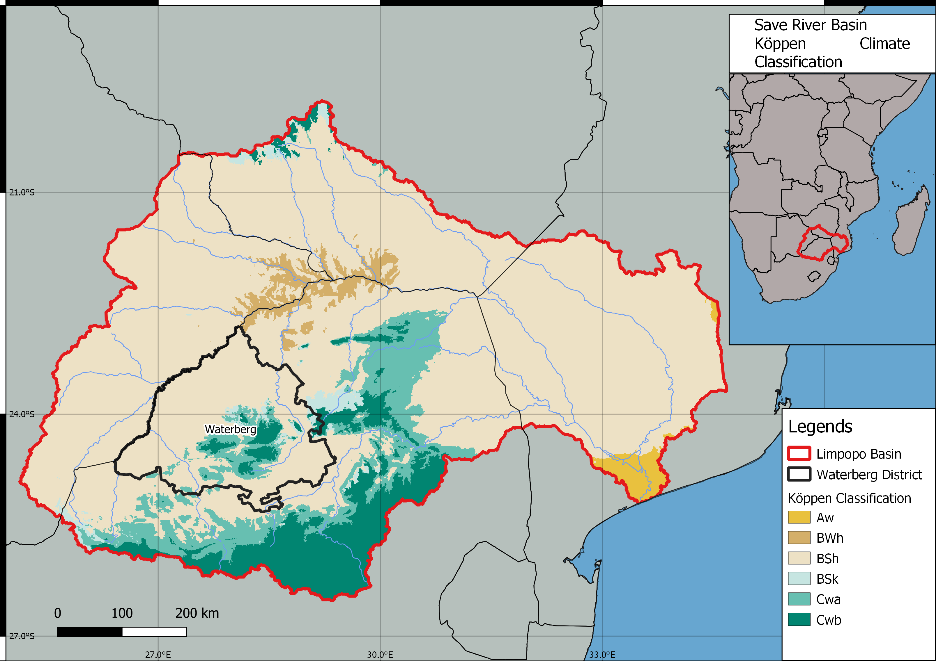
Figure 1: Limpopo River Basin: Climate calssification according to Koeppen (Map by Juan Miguel Viquez & Daniel Knopp).
Waterberg district is characterized by hot and semi-arid climate patterns in the North and North-West. The southern and eastern areas of the Waterberg District are more humid and slightly cooler (Department of Environmental Affairs, n.d.). These areas are the green areas in Figure 2 and indicate a CWb climate zone. The mean annual rainfall is around 577 mm, with high yearly mean evaporation of 2100 mm. The minimum average temperature per day is 11.9 ◦C, and the maximum daily average temperatures are around 27.2 ◦C (Netshipale et al., 2022).
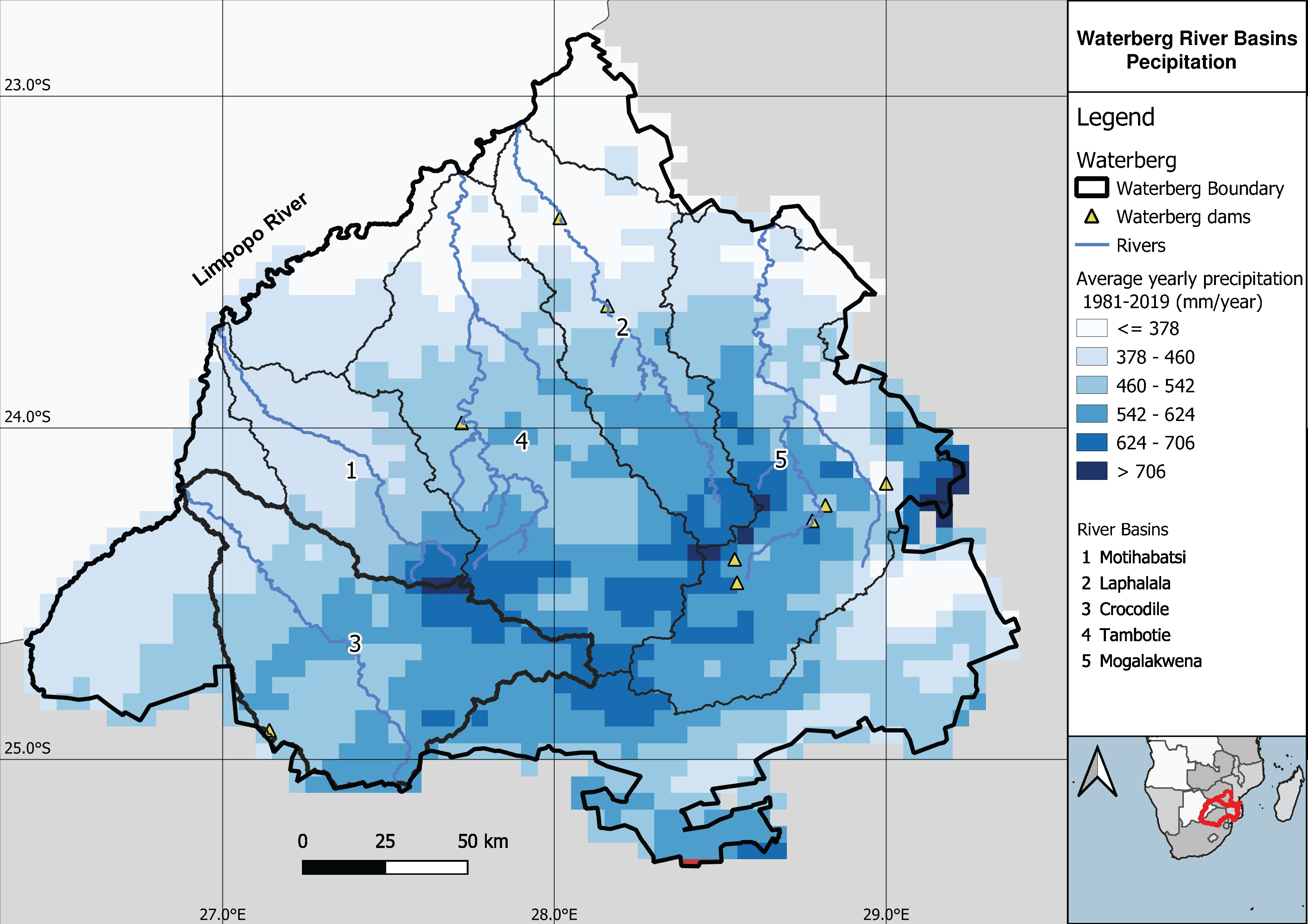
Figure 2: Waterberg District. Distribution of precipitation (Map by Juan Miguel Viquez & Daniel Knopp).
References:
The Department of Environmental Affairs (n.d.): Waterberg District Environmental Management Framework Report. Available at: https://www.dffe.gov.za/sites/default/files/docs/waterberg_finalreport.pdf
Knight, J. (2022): Geomorphology and Landscapes of the Limpopo River System. In: (Eckardt, F.D.) (ed.) Landscapes and Landforms of Botswana, Springer Cham, 287-298, doi: https://doi.org/10.1007/978-3-030-86102-5
Netshipale, A.J.; Raidimi, E.N.; Mashiloane, M.L.; de Boer, I.J.M.; Oosting, S.J. (2022): Farming system diversity and its drivers in land reform farms of the Waterberg District, South Africa, Land Use Policy (117), doi: https://doi.org/10.1016/j.landusepol.2022.106116