Tinto, Odiel and Piedras (Spain)
Authors: Raimundo José Vives Ansted & Tim Schöneich
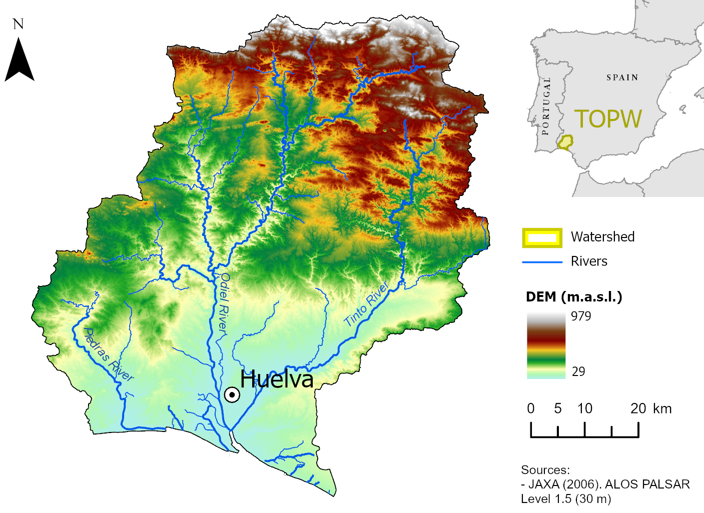
The Tinto, Odiel and Piedras (TOP) basin is located in southwestern Spain, Andalucía, between the Guadiana and Chanza river basins to the west and north, the mountain front of the Sierra de Aracena to the North-East, and the Atlantic coastline of the Gulf of Cádiz to the south. Covering a total area of 4955 km², out of which 4762 km² are continental, the basin falls almost entirely within the province of Huelva, which accounts for 98% of its territory and 99.86% of its population (Junta de Andalucía, 2022).
With 523 664 inhabitants, the TOP basin is demographically dominated by the city of Huelva, the only urban centre exceeding 100 000 residents, with a population of 143 663, which also concentrates the main industrial and port infrastructure of the basin (Junta de Andalucía, 2022). Land use across the basin reflects strongly contrasting trajectories: the central Cuenca Minera overlies the Iberian Pyrite Belt (IPB), one of the world's greatest concentrations of massive sulphide deposits, where mining activity spanning approximately 4 500 years (Olías & Nieto, 2015) has generated acid mine drainage that now represents the most widespread water quality pressure in the region (Junta de Andalucía, 2022). In the lowland and coastal zones, intensive irrigated agriculture, particularly horticulture and berry production, has expanded substantially since the mid-twentieth century (Rodríguez & De Stefano, 2012; Márquez Domínguez et al., 2023). Inland and northern areas are dominated by the Dehesa land use system, a traditional semi-natural agrosilvopastoral system of scattered oak trees managed for grazing and agroforestrywith soils of low fertility (Joffre et al., 1999).
Contact
Alexandra Nauditt: This email address is being protected from spambots. You need JavaScript enabled to view it.
Partners