NILE BASIN RESEARCH (N-AFRICA)
Natural Environment
Topography
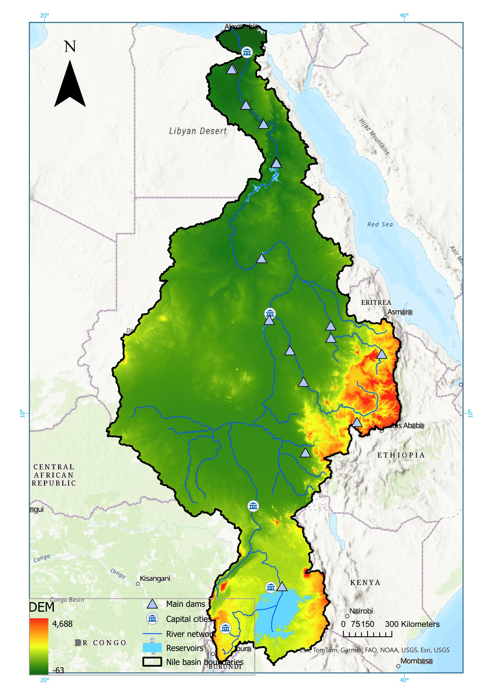
The Nile river basin encompasses various topographic landforms ranging from mountains and gorges to lakes, depressions, vast wetlands and flood wetlands with an average slope between 0 and 33 degrees. However, most of the watershed’s territory lies below 1,500 m in elevation (Berhanu et al., 2015).
Highlands and mountain ranges are located in the upper parts of the White Nile, Blue Nile and Tekeze- Atbara with a rough topography and steep slopes, then large plateaus spans along the middle reaches of the basin, while large floodplains are located from the lower reaches until the delta (NBI, 2016).
Geology
The foundation of the Nile consists of Precambrian igneous and metamorphic rocks, buried beneath a thick cover of predominantly Paleozoic, Mesozoic, and Cenozoic sedimentary formations. The geological formation and the elevation of the Ethiopian highlands owns their origins from the uplift and volcanic activity during the last 30 Million years. While the floodplains in Egypt and Sudan originates geologically from the weathered volcanic rocks, eroded and transported though rivers in the headwaters of Blue Nile and Atbara watersheds (Williams, 2018).
Soils
Different soil types are found in the Nile basin, with deep red loams developed mainly on highly weathered rocks in the tropical south of the basin, and weakly developed sandy soils mainly in dunes desert and weathered Nubian Sandstones in the arid zone.
Along the river Nile and its tributaries, alluvial soils known by their high fertility are found, which highly contributed to human settlements and development of the agricultural sector (Williams, 2018).
References
Berhanu, Belete, Seleshi, Y., Amare, M., & Melesse, A. M. (2015). Upstream–Downstream Linkages of Hydrological Processes in the Nile River Basin. In A. M. Melesse, Landscape dynamics, soils and hydrological processes in varied climates (pp. 207- 223). Springer Geography.
ESRI. (2025, April 7). World Cities [Shapefile]. doi:https://hub.arcgis.com/datasets/esri::world-cities/about
Lehner, B., & Grill, G. (2013). Global river hydrography and network routing: baseline data and new approaches to study the world’s large river systems. Hydrological Processes, 27(15), 2171–2186. doi:https://doi.org/10.1002/hyp.9740
Lehner, B., Reidy Liermann, C., C., R., Vörösmarty, C., Fekete, B., Crouzet, P., . . . and Wisser, D. (2011). High-resolution mapping of the world’s reservoirs and dams for sustainable river-flow management. Frontiers in Ecology and the Environment, 9(9), 494-502. Retrieved from https://doi.org/10.1890/100125
NASA, S. R. (2013). Shuttle Radar Topography Mission (SRTM) Global. Distributed by OpenTopography. Retrieved from https://doi.org/10.5069/G9445JDF
NBI. (2016). Chapter 2- Nile Basin Physiography. In N. B. (NBI), Nile Basin Water Resources Atlas (pp. 21-48). Nile Basin Initiative (NBI).
Williams, M. (2018). 4 Geology and Soils. In M. Williams, The Nile Basin Quaternary Geology, Geomorphology and Prehistoric Environments (pp. 33-58). Cambridge University Press. doi:https://doi.org/10.1017/9781316831885.005